News Summary
The National Weather Service has warned of strong thunderstorms affecting Newberry and Saluda counties, with wind gusts potentially reaching 50 mph. Residents are advised to seek shelter and prepare for hazardous conditions. The alert includes specific locations and highways under threat, emphasizing the risk of falling tree limbs and lightning. Additionally, a tornado watch has been issued for several counties, and a statewide burn ban is in effect due to high fire danger. Residents are encouraged to stay informed and follow safety protocols during this severe weather event.
Newberry, SC Issues Severe Weather Alert
The National Weather Service (NWS) Columbia SC has issued a weather alert for strong thunderstorms affecting Newberry and Saluda counties until 5:15 p.m. on Tuesday. Residents in the area should be prepared for wind gusts reaching up to 50 mph, as Doppler radar has detected a strong thunderstorm moving west at a speed of 15 mph.
The impacted locations include Newberry, Prosperity, Newberry College, Newberry County Airport, Silverstreet, Stoney Hill, Newberry County Detention Center, Scurry Airport, Bush River Fire Station, Hickory Grove, Mid-Carolina High School, and Belfast Wildlife Management Area. Additionally, Interstate 26 between mile markers 68 and 80 is also under this severe weather alert.
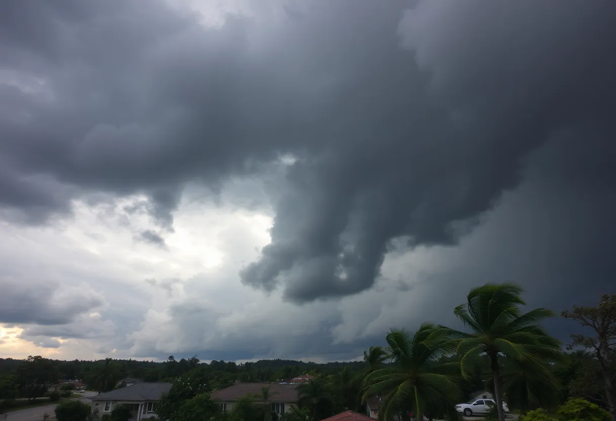
Weather Impact and Safety Recommendations
The NWS has warned residents that gusty winds could result in falling tree limbs and unsecured objects being blown around. In these circumstances, it is advisable for residents to seek shelter inside a building if they are outdoors. Lightning poses another threat during thunderstorms, with approximately 25 million lightning strikes reported in the U.S. annually, primarily in the summer months. Each year, lightning claims around 20 lives.
As thunderstorms approach, the risk of lightning increases, peaking when the storm is overhead. This risk decreases as the storm moves away. Therefore, it is crucial for residents to stay alert during such weather events, particularly if shelter options are limited.
Further Weather Alerts and Safety Precautions
On Thursday at 7:07 p.m., the NWS issued another alert for strong thunderstorms until 8 p.m., extending to Newberry, Fairfield, Lexington, and Richland counties. Wind gusts during this later storm may reach up to 55 mph. Doppler radar has identified a severe thunderstorm positioned 7 miles north of Dreher Island State Park, also moving north at 15 mph. The forecast indicates substantial rainfall, which could lead to localized flooding and frequent cloud-to-ground lightning.
Residents are strongly warned against attempting to drive through flooded roadways, as hydroplaning can occur when water accumulates more quickly than a vehicle can push it away, leading to sliding on the water’s surface. The NWS advises travelers to remain cautious, especially during morning commutes in affected areas.
Ongoing Weather Risks
A tornado watch is currently in effect for several counties until 1 p.m. on Thursday, with the strongest winds and storm impacts expected across various regions. Residents should prepare for potential power outages by charging electronic devices in advance and securing outdoor items to minimize damage from strong winds.
The severe weather alert coincides with a statewide burn ban, issued due to high fire danger conditions in the area. Residents are encouraged to stay informed of ongoing weather conditions and follow safety protocols during this period of inclement weather.
Deeper Dive: News & Info About This Topic
HERE Resources
Severe Thunderstorms Sweep Through Newberry and Saluda Counties
Unbearable Heat Wave Overtakes Central and Eastern U.S.
Devastating Tornado Outbreak in North Dakota Claims Three Lives
Powerful Derecho and Tornadoes Devastate North Dakota and Minnesota
Wildfires Force State of Emergency in South Carolina
Severe Heat Wave Sweeps Across Eastern U.S.
Severe Thunderstorm Alert Issued for Columbia and Surrounding Areas
Severe Flash Flooding Devastates Wheeling Community
Tragic Flash Flooding Claims More Lives in San Antonio
Severe Thunderstorm Warning in South Carolina
Additional Resources
- Herald Online – Severe Weather Alert
- Wikipedia: Weather Alerts
- Island Packet – Weather News
- Google Search: Severe Weather South Carolina
- ABC Columbia – Tracking Severe Weather
- Google Scholar: Severe Weather Precautions
- The State – Weather News
- Encyclopedia Britannica: Weather
- WLTX – Severe Weather Forecast
- Google News: Thunderstorms South Carolina
- Big Rapids News – Michigan Weather