News Summary
Newberry and Fairfield Counties are under a severe thunderstorm warning from the National Weather Service, with risks of marble-sized hail and wind gusts up to 50 mph. Residents are advised to seek shelter and prepare for potential dangers caused by intense winds and hail. Highway conditions are also being monitored as severe weather impacts major routes in the area.
Newberry, SC Faces Severe Thunderstorm Warning
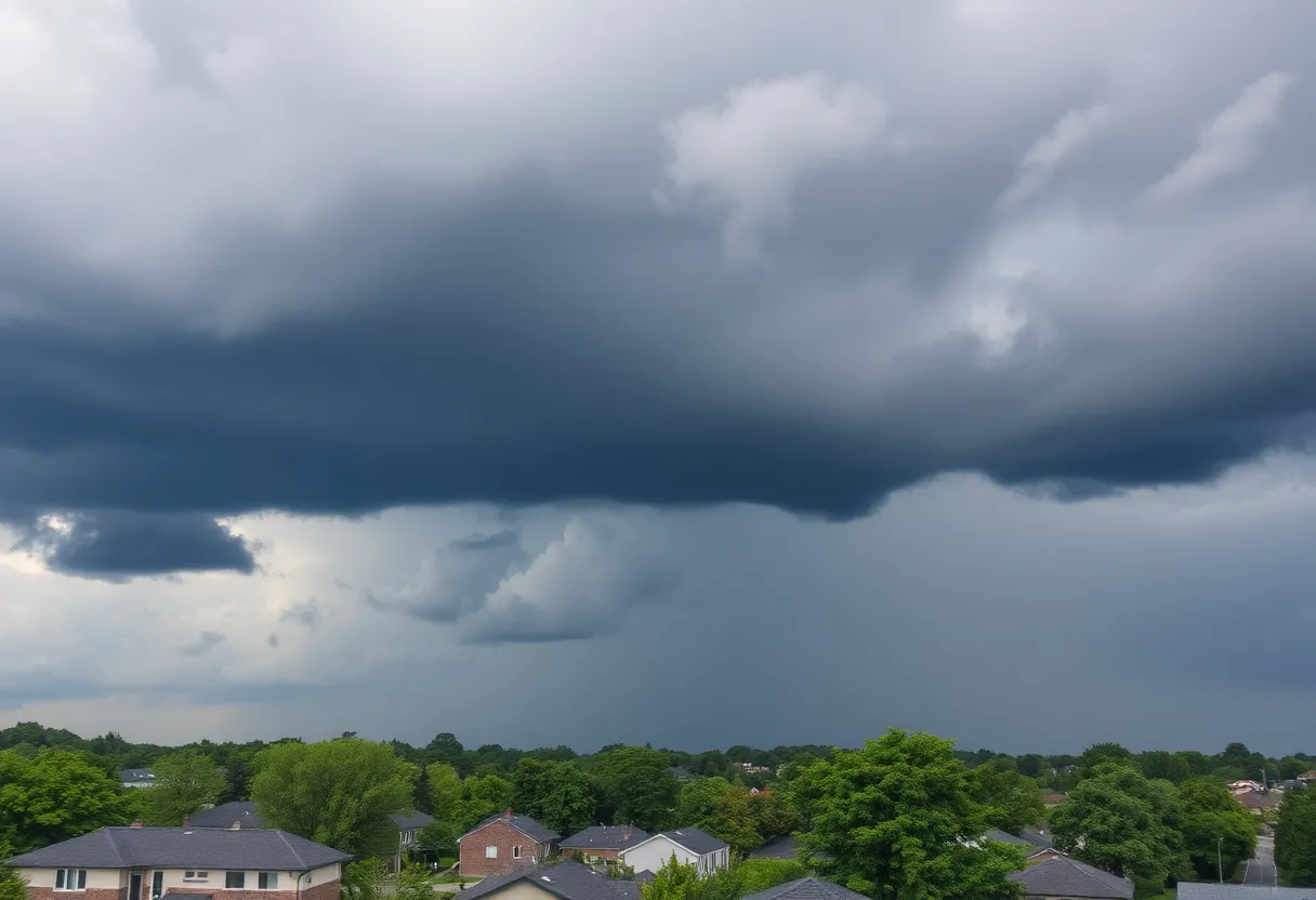
Newberry and Fairfield Counties are currently under a severe thunderstorm warning as issued by the National Weather Service (NWS) Columbia SC on Wednesday at 6:53 p.m. The warning is effective until 7:45 p.m. this evening, with residents advised to prepare for marble-sized hail and wind gusts that may reach up to 50 mph.
Current Storm Activity
Doppler radar indicates that the storm extends from near Blackstock to Blair and stretches to about six miles east of Joanna. The system is moving toward the south at a speed of 10 mph. The combination of intense winds and hail poses a risk, as these gusty conditions might lead to the falling of tree limbs and the scattering of unsecured objects in outdoor spaces.
Locations Affected
The thunderstorm warning affects multiple locations in the region, including:
- Newberry
- Winnsboro
- VC Summer Nuclear Station
- Whitmire
- Prosperity
- Jenkinsville
- Newberry College
- Monticello
- Newberry County Airport
- Blair
- Little Mountain
- Pomaria
- Silverstreet
- Peak
- Lebanon Fire Station
- US-176
- SC-34 Crossroads
- Henderson Island
- White Oak
- Enoree Ranger District Office
- Newberry County Detention Center
Highway Conditions
The severe weather is also impacting major highways in the area, particularly:
- Interstate 26 between mile markers 62 and 87
- Interstate 77 between mile markers 42 and 48
Safety Measures Recommended
Residents are urged to seek shelter indoors if they are outdoors during this storm. It is advisable to stay away from windows and avoid using electrical appliances. The National Weather Service has issued a Severe Thunderstorm Watch that will remain in effect until midnight for central South Carolina.
Understanding the Risks
Severe thunderstorms in the United States produce about 25 million lightning strikes every year, which can lead to approximately 20 fatalities annually. The likelihood of being struck by lightning increases as a storm approaches, reaching its peak when the storm is directly overhead.
Additionally, the dangers of driving in such weather should not be overlooked. Hydroplaning, which occurs when a vehicle slides uncontrollably on slick roads due to excess water, can be exacerbated by factors such as water depth, tire tread conditions, and the speed of the vehicle.
Conclusion
Residents of Newberry and Fairfield Counties are encouraged to stay alert and prepared during this severe weather event. By taking the necessary precautions, individuals can ensure their safety as these thunderstorms pass through the region.
Deeper Dive: News & Info About This Topic
HERE Resources
Severe Thunderstorm Warning Issued for Newberry and Fairfield Counties
Severe Thunderstorm Warning Issued for Newberry Area
Severe Thunderstorm Alert Issued for Newberry College Area
Severe Thunderstorm Warning Issued for Newberry and Saluda Counties
Severe Thunderstorm Watch Issued for Columbia, SC
Severe Thunderstorm and Tornado Warnings Issued for Central South Carolina
Severe Thunderstorm Warning Issued in Aiken and Edgefield Counties
Severe Thunderstorm Warning for Aiken and Edgefield Counties
Newberry, SC Issues Severe Weather Alert
Severe Thunderstorms Sweep Through Newberry and Saluda Counties
Additional Resources
- Herald Online: Severe Weather News
- Wikipedia: Severe Thunderstorm
- Island Packet: Weather News
- Google Search: Severe Thunderstorm Preparedness
- WLTX: Severe Weather Forecast
- Google Scholar: Severe Weather Impact
- Myrtle Beach Online: Weather News
- Encyclopedia Britannica: Thunderstorm