Severe Thunderstorm Alert Issued for Columbia and Surrounding Areas
Columbia, SC—a stormy night is in store as the National Weather Service (NWS) has issued an updated weather alert for strong thunderstorms that are expected to roll through the area until 11 p.m. The alert, which came out at 9:56 p.m., affects several counties including Northern and Southern Lancaster, Chesterfield, Newberry, Fairfield, Kershaw, Lexington, Richland, Lee, and Sumter.
Residents should be on high alert for wind gusts reaching up to 55 mph! You might want to secure any loose outdoor items if you haven’t done so already, as these gusty winds could easily knock down tree limbs and send unsecured objects flying about.
What’s Happening?
According to the NWS announcement, Doppler radar has been tracking strong thunderstorms that form a line stretching from 6 miles southeast of Carlisle, right up to near the Fairfield County Airport, and moving toward areas like Killian and Pine Ridge. The storm is racing northeast at 45 mph, so if it hasn’t reached your neighborhood yet, it’s definitely on its way!
Areas impacted by this alert include Columbia, West Columbia, Cayce, Irmo, Forest Acres, Lancaster, Camden, Winnsboro, Bishopville, Springdale, Dentsville, Oak Grove, Lake Wateree Dam, St. Andrews, VC Summer Nuclear Station, Highway 6 at Lake Murray Dam, Indian Land, Waxhaw, Pageland, and South Congaree.
This alert also affects key highways in the region, including:
- Interstate 126 between mile markers 0 and 3
- Interstate 20 between mile markers 58 and 117
- Interstate 26 between mile markers 95 and 117
- Interstate 77 between mile markers 0 and 51
If you happen to be outdoors during this storm, the NWS advises you to seek shelter indoors immediately. This quick action can make a big difference in staying safe throughout the night.
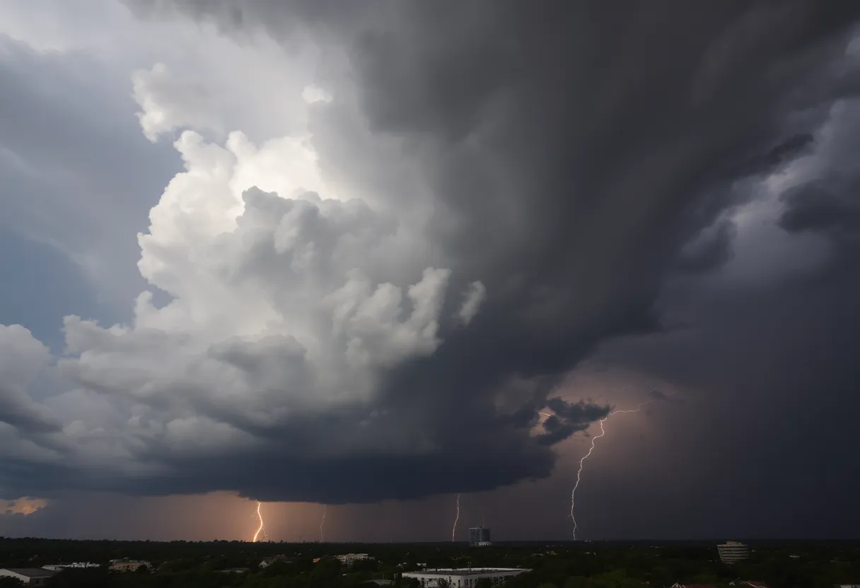
Stay Safe with Lightning Awareness
Did you know that around 25 million lightning strikes occur in the United States every year? Most of these strikes happen during the summer months, and the NWS reports about 20 lightning-related fatalities annually. The risk of lightning strikes increases as a storm approaches and peaks when the storm is directly above you, tapering off as it moves away. So keep an eye on those dark clouds!
Here are some quick tips to help you stay safe during a thunderstorm:
- If you can’t get inside, find a low-lying area and stay away from tall objects.
- Avoid using corded phones and electrical appliances.
- Stay away from windows and doors to protect yourself from flying debris.
Understanding Hydroplaning
Speaking of storms, let’s chat about road safety during wet weather. If you’ve ever found your car sliding uncontrollably on a wet road, you’ve experienced hydroplaning. This occurs when water builds up in front of your tire more quickly than your vehicle’s weight can push it out of the way, leading to a loss of traction. Remember, the top three causes of hydroplaning are:
- Driving too fast for road conditions
- Worn tires
- Standing water on the road
So if you find yourself hydroplaning, the best thing to do is stay calm. Don’t slam on the brakes; instead, ease off the gas and steer straight until you regain control.
Stay safe, Columbia! Keep your weather radio or cellphone handy in case of further updates. Remember, sometimes a friendly reminder is all it takes to keep our community safe during Mother Nature’s unpredictable moods.