Thunderstorm Alert Hits Columbia, SC: What You Need to Know
Columbia, SC, brace yourselves! The National Weather Service (NWS) has rolled out an updated weather alert as of 8:54 p.m. Wednesday evening, warning residents about strong thunderstorms affecting Newberry and Lexington counties until 9:45 p.m. This alert is particularly important for areas like Chapin, Melvin Park, and Little Mountain. So, if you’re in those regions, it’s time to pay attention!
What to Expect
Forecasters are predicting wind gusts that could reach up to 50 mph, along with penny-sized hail (about 0.75 inches). If you’re wondering how serious that is, think about the potential for gusty winds to knock down tree limbs and send unsecured items flying—all potentially leading to minor damage outside your home.
The NWS mentioned that at 8:53 p.m., they received reports of a strong thunderstorm near Dreher Island State Park, which is located about nine miles northwest of Highway 6 at Lake Murray Dam. The storm is currently moving northwest at a speed of just 5 mph, so it’s hovering, which means these conditions may last a little while longer.
Stay Safe!
As always during thunderstorms, safety is key. The NWS advised that those outdoors should consider seeking shelter immediately inside a building. If you’re driving and find yourself caught in these stormy conditions, it’s crucial to be extra cautious! Keep an eye out for the chances of hydroplaning—a slippery situation that can occur when water builds up in front of your vehicle’s tires, causing you to lose traction and control.
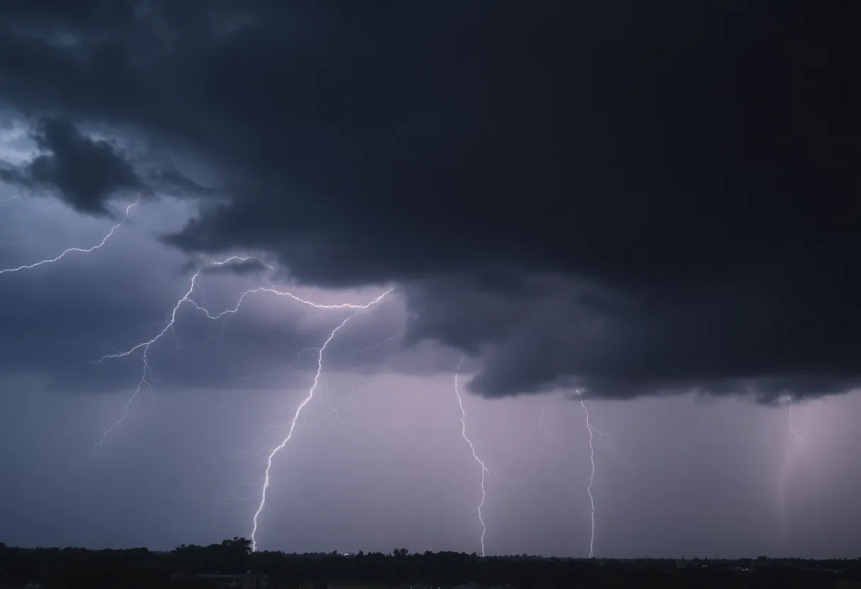
Just a reminder: lightning is a real danger during thunderstorms. With about 25 million strikes hitting the U.S. every year, the majority occur in the summer months and can tragically result in around 20 fatalities annually. The risk of lightning increases as a thunderstorm approaches, reaching its peak when the storm is directly overhead. This risk tapers off as the storm moves away, so it’s important to remain alert and indoors for safety.
How Hydroplaning Happens
If you’re curious about hydroplaning, here’s a simple breakdown. Hydroplaning occurs when water accumulates in front of your tires faster than your vehicle’s weight can push it away. The water then creates a layer that causes the vehicle to lift and lose grip on the road, making it slide uncontrollably.
Typically, hydroplaning can be attributed to factors such as:
- Wet road conditions
- High speed
- Tread wear on your tires
If you find yourself in a situation where your vehicle starts to hydroplane, remain calm! Here’s what you should do:
- Stay off the brakes! Sudden braking can make it worse.
- Steer gently in the direction you want to go.
- Allow your speed to decrease until you regain traction.
Final Thoughts
As this thunderstorm rolls through, remember to stay safe and secure indoors to avoid those potential hazards. Keeping an eye on local weather updates will provide you with the latest alerts and details. And if you do have to venture out, be cautious on the roads to avoid hydroplaning! We’re all in this together, so let’s look out for one another. Happy storm watching, Columbia!