Columbia, South Carolina, September 5, 2025
News Summary
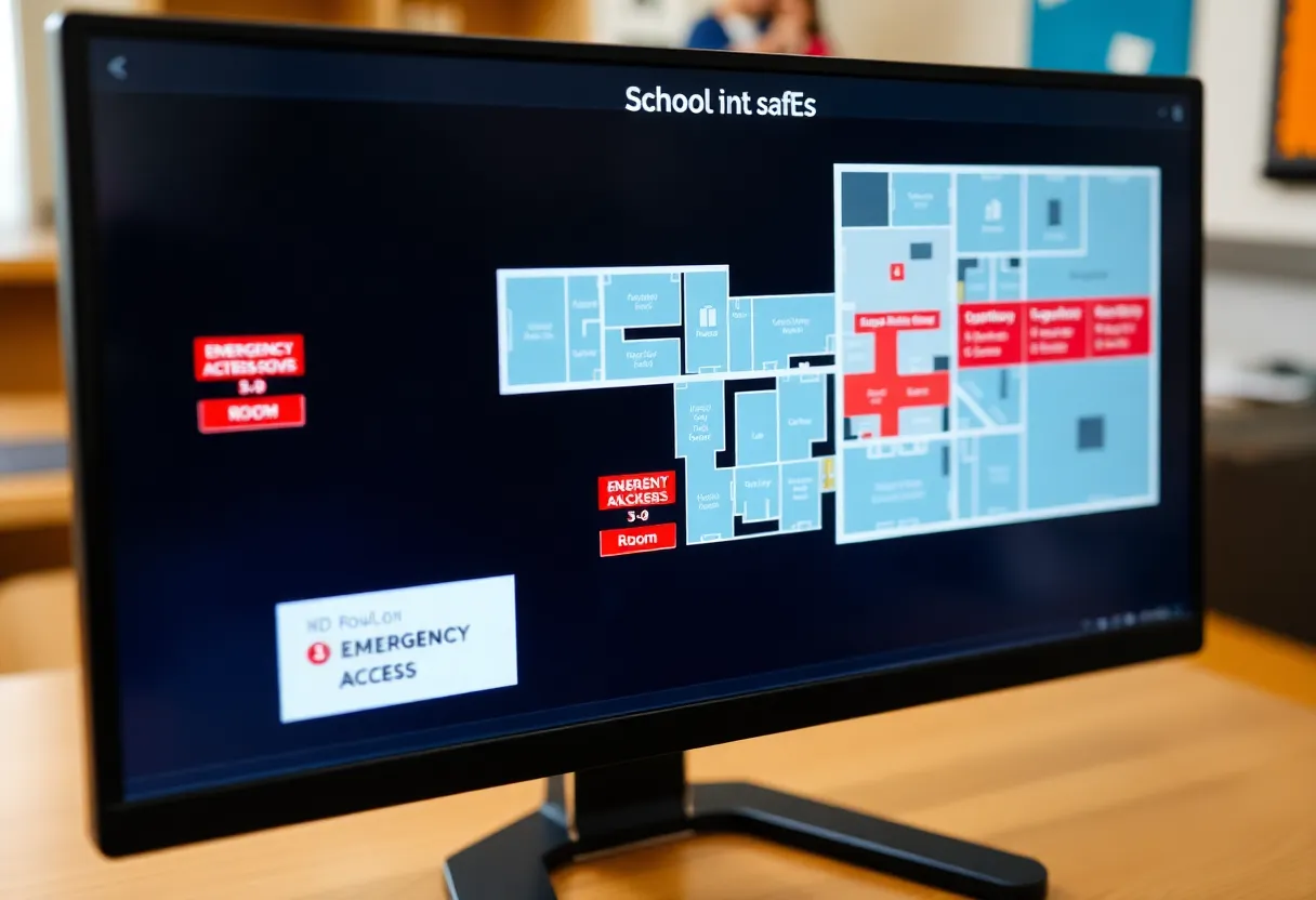
The South Carolina Department of Education has partnered with Critical Response Group to create digital maps for every public K-12 school in the state. This initiative aims to improve safety and emergency preparedness by providing first responders with essential information about school layouts. The digital maps will include features such as high-resolution imagery, floor plans, and access points, enhancing responders’ situational awareness during emergencies. Access will be restricted to law enforcement and emergency personnel, with statewide implementation expected by early 2026.
Columbia, South Carolina – The South Carolina Department of Education has announced a new initiative to create detailed digital maps for every public K-12 school in the state. This partnership with Critical Response Group (CRG) aims to enhance safety and emergency preparedness following a string of school violence incidents across the nation, including a tragic shooting in Minneapolis that resulted in the deaths of two children.
The digital maps will serve as critical tools for first responders, providing them with essential information about the layout of school buildings. Each map will feature detailed floor plans, stairwells, access points, and high-resolution imagery. This data will facilitate quicker and more efficient responses in emergencies, ensuring responders can navigate complex school environments with ease.
Access to the digital maps will be restricted to law enforcement and emergency responders, who will be able to utilize the information securely via smartphones or laptops. The goal is to have the digital mapping system implemented statewide by early 2026. In addition to improving situational awareness, the maps will include a gridded reference system to enhance communication during emergencies, as well as clearly labeled rooms and corridors.
Richland County Sheriff Leon Lott has emphasized the importance of this mapping system, calling it a “game changer” for emergency preparedness, noting that response times could be greatly reduced, which could be critical in saving lives. Newberry County Sheriff Lee Foster also underscored the significance of equipping responders with knowledge of school layouts, particularly for those who may not regularly respond to incidents in local schools.
Parents in the community have voiced their concerns regarding school safety in light of ongoing violence, making this initiative even more timely. The detailed digital maps are expected to improve the confidence of parents, students, and staff in the safety measures being put in place while creating a safer educational environment for all.
The Department of Education has not disclosed the overall cost of the project or its funding sources. However, Superintendent Ellen Weaver has conveyed that the mapping project utilizes state-of-the-art technology aimed at enhancing the preparedness of first responders during critical incidents. South Carolina Governor Henry McMaster has praised this initiative as a significant step towards ensuring safer schools in the state.
Project Details
- Partnership: South Carolina Department of Education and Critical Response Group.
- Main Features: High-resolution imagery, structural blueprints, stairwells, access points.
- Access: Restricted to law enforcement and emergency responders.
- Timeline: Implementation aimed for early 2026.
Background Context
The initiative comes amid rising alarm over school safety following several incidents of violence in educational settings. Recent tragic events have sparked dialogues around the need for enhanced safety measures and preparedness training for first responders. By creating a comprehensive digital infrastructure, the initiative not only acts as a preventive measure but also aims to reassure concerned parents and guardians regarding their children’s safety.
Frequently Asked Questions (FAQs)
What are the digital safety maps?
The digital safety maps are detailed layouts of every public K-12 school in South Carolina, designed to aid first responders during emergencies.
Who will have access to the maps?
Access to the maps will be restricted to law enforcement and emergency responders, ensuring that only authorized personnel can use them in crisis situations.
Why is this initiative being launched?
The initiative is a response to rising concerns about school safety and aims to improve emergency preparedness, following recent incidents of school violence.
When will the digital maps be ready?
The statewide implementation of the digital mapping system is targeted for completion by early 2026.
What technology is being utilized in this initiative?
The project will employ state-of-the-art technology to ensure that the maps are detailed and functional for first responders during critical incidents.
Key Features of the Digital Mapping Initiative
| Feature | Description |
|---|---|
| High-Resolution Imagery | Detailed visuals of school layouts for better navigation. |
| Floor Plans | Comprehensive blueprints of school buildings. |
| Emergency Access Points | Marked entry and exit points for emergency personnel. |
| Gridded Reference System | Facilitates efficient communication during emergencies. |
| Room and Corridor Labels | Clearly identifies various areas within schools. |
Deeper Dive: News & Info About This Topic
HERE Resources
12-Foot Albino Python Captured in Newberry, South Carolina
Man Sentenced to Over Eight Years for Gun Possession in SC
Chapin Elementary School Begins Construction on New Classroom Wing
Tragic Fatal Crash in Newberry County Claims Life
Columbia University Settles Anti-Semitism Claims for $221 Million
Bridge Closures Impacting Traffic in Newberry County
Senate GOP Reveals Revised $4.2 Trillion Tax and Spending Package
Newberry Police Launches Fan Initiative for Vulnerable Residents
Tensions Rise in Downtown Los Angeles Amid ICE Raids
School District 56 Unveils New Academic Calendar and Policies
Additional Resources
- WLTX: South Carolina School Digital Maps Initiative
- WLTX: South Carolina Digital Safety Maps Announcement
- WISTV: Guide to 2024 SC State Fair
- Newsweek: States Exempting Elderly from Property Taxes
- WLTX: Richland Two School Zone Redrawing Consideration
- Wikipedia: Emergency Management
- Encyclopedia Britannica: Emergency Management