Newberry, SC, August 29, 2025
News Summary
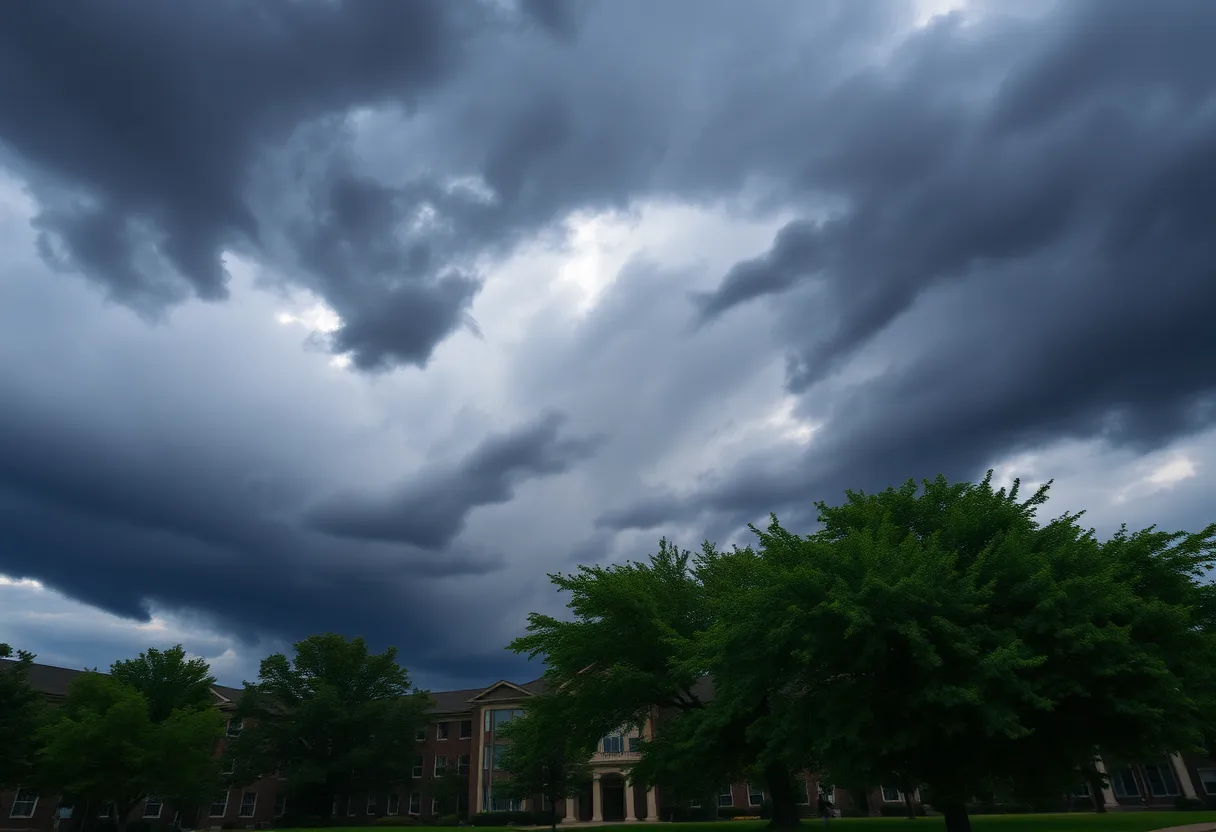
The National Weather Service has issued a severe thunderstorm warning for Newberry College and adjacent regions, with expected strong thunderstorms to impact the area. Winds may reach 50 miles per hour, and pea-sized hail is reported. Residents are advised to seek shelter and stay cautious while driving, due to the increased risks of hydroplaning and potential lightning. Power outages have already been recorded, with emergency services working to restore electricity. Safety recommendations urge moving to sturdy buildings and monitoring local weather updates.
Newberry, SC – The National Weather Service (NWS) issued a severe thunderstorm warning for Newberry College and surrounding areas Thursday evening, warning residents of strong thunderstorms expected to affect the local region. The alert was initiated at 7:01 p.m. and remains in effect until 7:30 p.m.
The warning indicates that thunderstorms are bringing dangerous wind gusts of up to 50 miles per hour and are producing pea-sized hail measuring approximately 0.25 inches. At the time of the alert, Doppler radar detected a powerful thunderstorm directly over Newberry College, moving south at a speed of 15 miles per hour.
Areas impacted by this weather alert include Newberry, Newberry County Airport, Pomaria, Silverstreet, and the Newberry County Detention Center. Furthermore, Interstate 26 between mile markers 64 and 81 falls under the alert zone, placing motorists at increased risk of hazardous driving conditions.
In light of the impending storm, the NWS advises individuals outdoors to seek shelter inside a sturdy building to ensure their safety. With approximately 25 million lightning strikes occurring annually in the U.S.—mostly during summer months—the risk for lightning is particularly elevated as thunderstorms approach, peaking when the storm is overhead.
During thunderstorms, gusty winds pose a threat by potentially downing tree limbs and enabling unsecured objects to become projectiles, which can lead to minor damage to outdoor items. Drivers are also urged to maintain safe distances on wet roads, extending the typical two-second rule to four seconds, and to navigate with caution as visibility can decrease during heavy rains.
Hydroplaning is another significant concern during storms when vehicles may slide on wet surfaces due to water accumulation in front of their tires, thereby increasing the risk of accidents. NWS safety recommendations encourage individuals to move to interior rooms when indoors and to wait for an ‘all-clear’ signal after the storm has passed.
Power outages have been reported across several counties, with Newberry County experiencing notable impacts where emergency services are currently working to restore electricity. As of Sunday noon, a total of 843 residents were reported to be without power in the area.
In addition to Newberry, a severe thunderstorm warning was also issued for Chippewa and Mackinac counties, affecting areas including Trout Lake and Epoufette until 5:45 a.m. EDT. Local emergency services are closely monitoring the situation for further developments.
Background on Thunderstorm Safety
Thunderstorms can produce various dangerous weather phenomena such as heavy rain, hail, strong winds, and lightning. The initial half-hour of rainfall is particularly treacherous for drivers as roads become slick due to a combination of rain, grime, and oil, potentially leading to accidents. To enhance visibility during poor weather, drivers are encouraged to turn on their headlights and remain cautious of larger vehicles that can block sightlines.
Key Recommendations During Thunderstorms
- Seek shelter indoors.
- Maintain safe distances from large vehicles and road edges.
- If visibility is low, pull over and wait for conditions to improve.
- Avoid parking or walking near culverts or drainage ditches.
FAQ
What should I do if a thunderstorm warning is issued?
Seek shelter indoors, move away from windows, and stay updated with local weather advisories.
How can I stay safe while driving during a thunderstorm?
Increase following distances, avoid sudden stops, and use headlights to improve visibility.
What is hydroplaning, and how can it be avoided?
Hydroplaning occurs when a vehicle slides on wet roads. To avoid it, reduce speed and ensure tires are properly inflated and tread is adequate.
What areas are affected by the severe thunderstorm warning?
The warning includes Newberry, Newberry County Airport, Pomaria, Silverstreet, and areas along Interstate 26 between mile markers 64 and 81.
Deeper Dive: News & Info About This Topic
HERE Resources
Massive Haboob Dust Storm Hits Arizona – Visibility Reduced
Severe Thunderstorm Alert Issued for Newberry County
Severe Thunderstorms Cause Disruptions in Newberry County
Strong Thunderstorms Sweep Through Newberry County
Severe Road Closures in Newberry County Due to Flooding
Newberry County Faces Road Closures After Severe Overnight Flooding
Flash Flood Warning Issued for Lexington, Newberry, and Saluda Counties
Severe Storms and Record Flooding Hit Wauwatosa, Wisconsin
Newberry Reschedules National Night Out to August 19
Newberry County EMS Faces Staffing Crisis Amid Rising Demand
Additional Resources
- The State: Severe Thunderstorm Warning in Newberry, SC
- MLive: Thunderstorms with Hail in Chippewa and Mackinac Counties
- Herald Online: Weather Update on Severe Storms
- ABC Columbia: Power Outages in Midlands Due to Severe Weather
- Weather.com: Current Weather in Newberry, SC
- Wikipedia: Thunderstorm
- Google Search: Thunderstorm Safety
- Encyclopedia Britannica: Thunderstorm
- Google News: Severe Weather Updates
- Google Scholar: Thunderstorm Impact