News Summary
A severe thunderstorm warning has been issued for Newberry and Fairfield counties, effective until 6 p.m. Residents should be aware of possible wind gusts of up to 50 mph and take precautions. The storm has been tracked near Monticello and could cause localized flooding. The National Weather Service advises securing loose outdoor items and staying indoors during the storm. Hydroplaning is a concern on wet roads, and drivers should remain vigilant. Safety guidelines should be followed to mitigate storm risks.
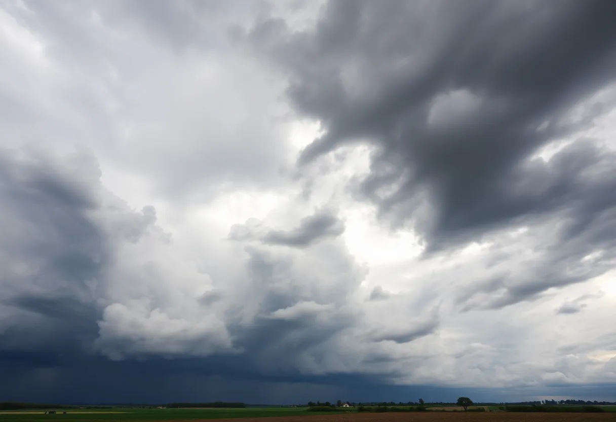
Newberry, SC – A severe thunderstorm warning has been issued for Newberry and Fairfield counties, effective until 6 p.m. this evening, as indicated by an updated report from the National Weather Service (NWS) in Columbia, South Carolina, released at 5:35 p.m. The warning alerts residents to the possibility of wind gusts reaching up to 50 mph, which could cause damage and pose risks to safety.
As the storm progresses, Doppler radar has tracked a strong thunderstorm over Monticello, roughly located near the VC Summer Nuclear Station, moving eastward at a speed of 15 mph. The NWS has cautioned residents in the affected areas to secure loose objects outdoors to prevent them from being blown around by the gusty winds and to seek shelter indoors if they are outside.
The specific locations impacted by the thunderstorm warning include:
- Winnsboro
- VC Summer Nuclear Station
- Fairfield County Airport
- Monticello
- Jenkinsville
- Peak
- Rion
- Winnsboro Mills
- Fairfield Elementary School
- Lebanon Fire Station
- White Oak
- Fairfield County Detention Center
Along with the strong winds, the storm brings torrential rainfall, which is expected to result in localized flooding in some areas. Residents are warned against driving through flooded roadways, as this poses a severe risk to personal safety and vehicle control.
The thunderstorm alert remains in effect until 6 p.m., and residents should take appropriate precautions during this time. It is important to be aware of the dangers associated with thunderstorms, including the risk of lightning strikes. The NWS reports that around 25 million lightning strikes occur across the United States each year, mainly during the summer months. These strikes lead to approximately 20 fatalities annually. The likelihood of a lightning strike rises as a thunderstorm approaches and peaks while the storm is overhead, before decreasing as it moves further away.
In light of the approaching severe weather, the NWS has provided recommendations for safety during thunderstorms. For those driving, hydroplaning is a particular concern during heavy rains. Hydroplaning occurs when a vehicle slides uncontrollably on wet roads, which can happen when water accumulates faster than a vehicle can push it away. This can result in a loss of control, especially if drivers are not aware of the conditions that lead to hydroplaning.
Although the specific factors contributing to hydroplaning were not listed, it is essential for drivers to remain vigilant and to understand the appropriate actions to take if they experience hydroplaning. If a vehicle begins to hydroplane, drivers are advised to remain calm, ease off the accelerator, and avoid sudden turns or braking to regain control.
As the storm approaches, residents in Newberry and Fairfield counties are strongly urged to remain informed and prepared. Staying tuned to local weather updates and following safety guidelines can help mitigate the risks associated with severe weather conditions.
Deeper Dive: News & Info About This Topic
HERE Resources
Severe Thunderstorm Alert for Aiken and Surrounding Areas
Tragic Accident Claims Life in Newberry, SC
Severe Thunderstorms Cause Widespread Power Outages in South Carolina
Tropical Depression 3 Develops Off the Southeastern U.S. Coast
Thunderstorm Alert for Fairfield County: Stay Safe!
Severe Thunderstorms Cause Power Outages in Columbia
Newberry, SC Faces Severe Thunderstorm Warning
Severe Thunderstorm Warning Issued for Newberry and Fairfield Counties
Severe Thunderstorm Warning Issued for Newberry Area
Severe Thunderstorm Alert Issued for Newberry College Area
Additional Resources
- Herald Online – Weather News
- WLTX – Severe Weather Forecast
- ABC Columbia – Storms in the Midlands
- The Weather Channel – Newberry, SC
- Free Press – Northern Michigan Storms
- Wikipedia: Thunderstorm
- Google Search: Severe Weather Safety
- Google Scholar: Thunderstorm Safety
- Encyclopedia Britannica: Thunderstorm
- Google News: Severe Weather March 2025